Category: Mapinfo
PostGIS is a great spatial database that supports various GIS applications such as Mapinfo Professional, Global Mapper, ArcGIS, QGIS and many more. In this article, I am going to show you how to export layer…

Hello, welcome to my Mapinfo Tutorial. Today, we are going to learn a basic Mapinfo Professional task, open CSV file. Mapinfo supports various data types including CSV. CSV is a delimited file (comma, tab or…

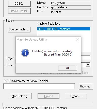
PostGIS is a great spatial extension for PostgreSQL server. This extension enables us to store spatial datasets directly to PostgreSQL database from various GIS software. On this article, I am going to show you how…
Please read our previous part of this tutorial How to Build a Free MS SQL Server Spatial Database Using Docker. On this article, we are going to continue connecting to SQL Server container from some popular…