Hello everyone, in this article, we will learn how to create a point layer from an MS Excel table in ArcGIS Pro. ArcGIS Pro supports various external table file formats such as CSV, XLS, XLSX, and many more. This capability makes it easier for us to convert the existing table into a point layer. In order to create XY points from Microsoft Excel files, we need to ensure that the file comes with X and Y columns. This X column represents the Easting and Y represents the Northing.
Below is an example of my MS Excel file. It has Easting (Point_X), Northing(Point_Y) columns in it.

We will use the coordinates to create a point layer in ArcGIS Pro.
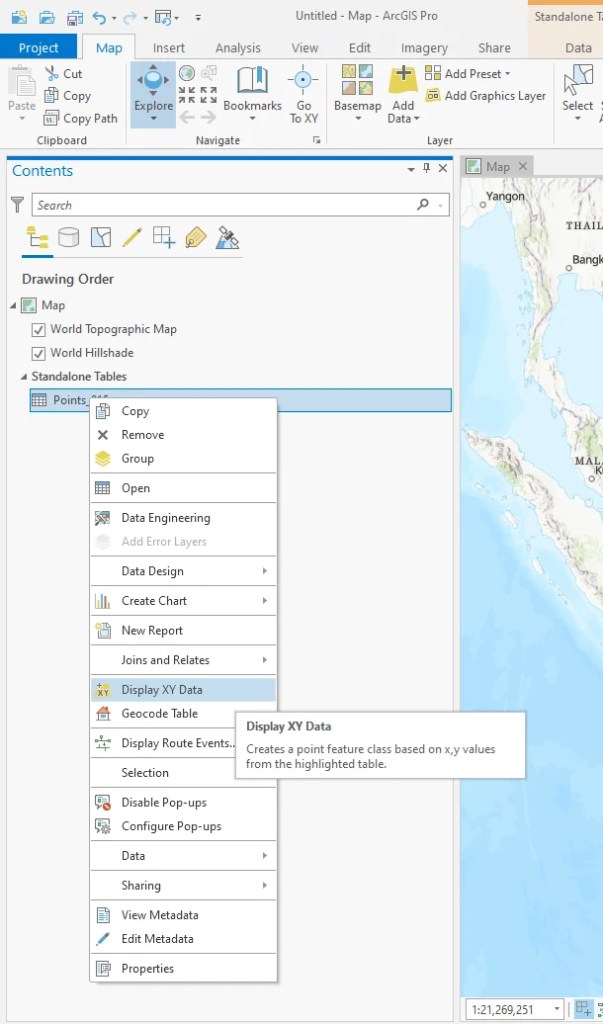
Open the Excel file in ArcGIS Pro. And then right-click the table and choose Display XY data

Next, choose the output, X_field, Y_field as well as the coordinate system.

Press OK and now the point should be displayed on ArcGIS Pro Map window.

Done. We have just successfully created a point layer from a Microsoft Excel file on ArcGIS Pro.
