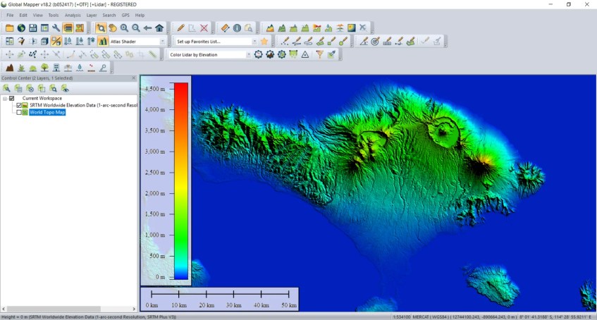
Personally, I do love this feature on Global Mapper. It is very easy to access the online data from Global Mapper. On this article, I am going to show you how to open the Online worldwide SRTM Elevation data on Global Mapper. We don’t have to type or add url for the online service. By default, GM comes with this feature.
How to open Online SRTM Worlwide Elevation Data on Global Mapper
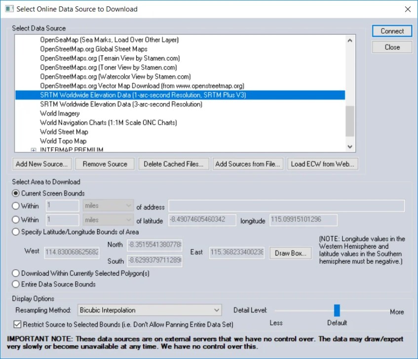
First, open Global Mapper and then go to File | Download online Imagery/Topo/Terrain Maps. Select SRTM Worldwide Elevation Data from the list.
Click Connect and wait for few seconds until all the data loaded completely. Please note that you will need a working internet connection to download the SRTM data. Additionally, you can also specify the area to download. If you have specific region or area, you can enter the coordinate here.
Thanks for reading this Global Mapper tutorial to open SRTM Worldwide Elevation data. Please share this article if you think its useful. Cheers.


[…] Global Mapper is a complete GIS software. One of my favorite features is the ability to open and download online data source. For example, we can easily load the World Imagery to Global Mapper. This tutorial is going to show you how to open online World Imagery on Global Mapper. It’s a useful feature when you need to create maps with world imager as the background. Google Earth is a great example of the free online world imagery. But, unfortunately, Google Earth is not well connected to Global Mapper. On my previous tutorial, you can see how to open Online SRTM data on Global Mapper. […]
[…] generate contour from Online SRTM data on Global Mapper. On my previous tutorial, we have learned how to open online SRTM data on Global Mapper. When you need elevation contour for certain area, this online SRTM data can be an option. […]
[…] Open or load the SRTM data to Global Mapper. You can use both local files or simply open the Online SRTM Data. […]