
The Shuttle Radar Topography Mission (SRTM) is an international research to obtain the Digital Elevation Model (DEM) of the earth. It provides or generates a global scale of high-resolution digital topography database. If you are new to SRTM, I would recommend you to read the Wikipedia. You will get a high-level knowledge of the SRTM. If you are new to QGIS, you will get benefit from this article because we will show you how to open SRTM file on QGIS. So, basically on this article, you will learn the following:
- How to obtain SRTM data for a specific area for free
- Open and visualize the SRTM data on QGIS
How to Obtain SRTM Data for Free
A. Download SRTM Data from EartExplorer
I would recommend you to visit the EartExplorer as your first place to obtain the Digital Elevation Model data. There are many kinds of GIS dataset you can download for free. In order to use the EarthExplorer service, you will need to create an account. It is free. You can visit this page to create a new account. Once you create a new account, log in to this page.
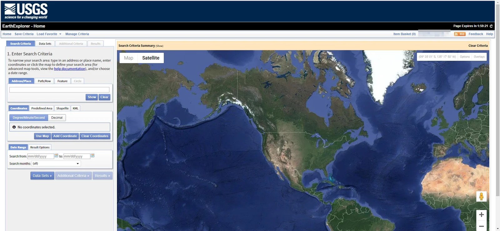
Next is to define the area of interest. You can create an area by manually clicking on the map, add coordinate, or even upload shapefile of the area to the website. And then click the Data Sets to choose which data you want to download. There are many data sets you can choose. In this case, we are going to download the SRTM data, so choose SRTM which is located under Digital Elevation.

In most case, I would recommend to choose the SRTM 1 Arc_Second Global. Next, click Results to see the result.

Click the Download icon to open the download option. There will be several options you can choose.

You can choose the download format. BIL, DTED and GeoTiff are supported by QGIS.
How to Open SRTM file on QGIS
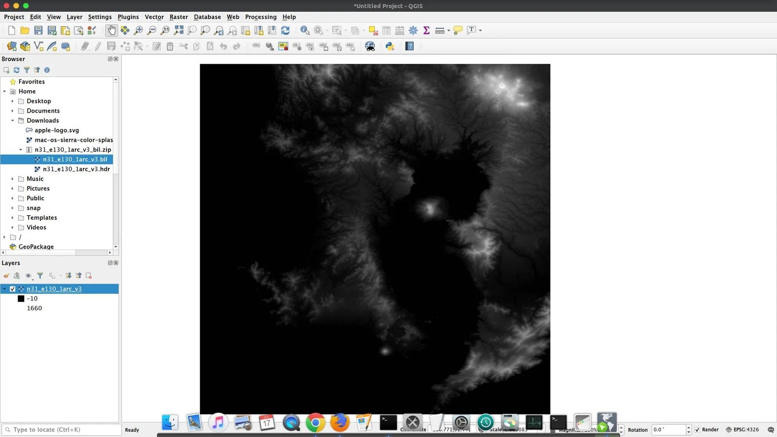
After you download, open QGIS and we are going to open this data on QGIS canvas for visualization. Mostly, you will get a zip file when you choose the BIL and DTED format. You will need to extract the zip file. Simply drag and drop the .bil file to the QGIS canvas.
B. Download STRM using SRTM Downloader Plugin
There is an easier way to download SRTM data on QGIS. With a special plugin, we can easily download the online SRTM data directly from QGIS. This plugin needs to be installed first. The name of the plugin is SRTM downloader.
Install SRTM Downloader Plugin
Go to Plugins | Manage and Install Plugin. Search for SRTM Downloader

Click Install plugin to start the installation. Once the installation completes, there will be a new menu SRTM Downloader under Plugins.
To use the plugin, click SRTM Downloader and then specify the extent
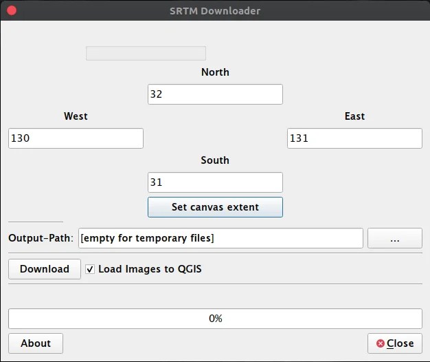
You can enter the extent coordinate manually, or use the Set canvas extent to use the current canvas extent. Specify the output path and file name. Click Download to start he download process. You will need to enter your EarthData login credential. You can create a new account from the following link:
https://urs.earthdata.nasa.gov/
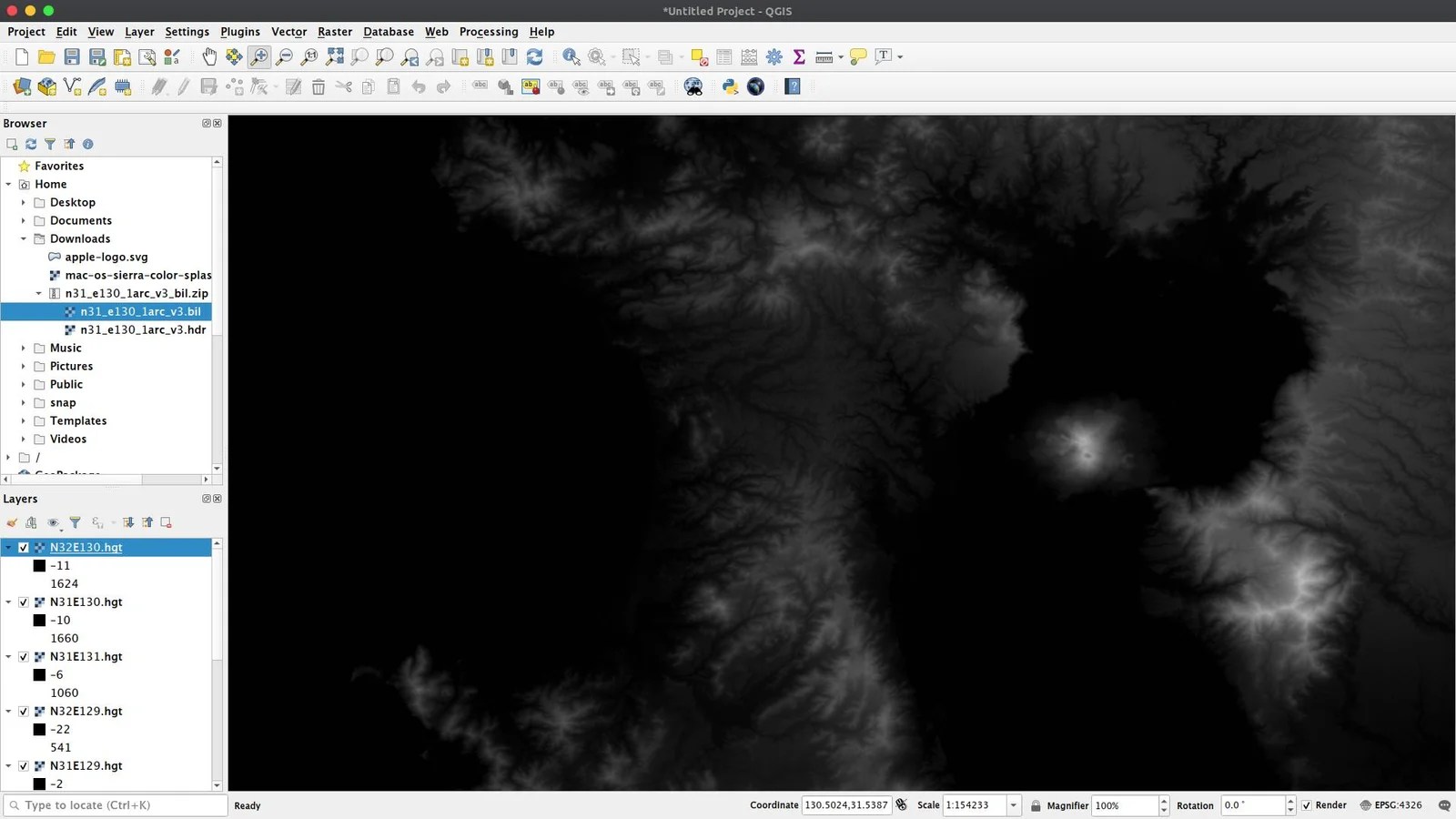
Wait until the download process is completed.
Closing Words
SRTM is a valuable data that is available for free (the paid version also available with more up to date version). QGIS is capable to handle the SRTM pretty well. We can visualize and presented the SRTM data into various types. Thank you for reading this how to open SRTM file on QGIS tutorial. We hope you enjoy the article and see you in the next tutorials.
[…] get started. First download and open the SRTM file to QGIS. You may follow this tutorial to download and open SRTM in QGIS. Next, right-click the DRTM layer and click […]