

Welcome to another QGIS tutorial for beginners. In this article, we are going to learn how to clip polygon with another polygon in QGIS. Before we go through the tutorial, I just want to share…
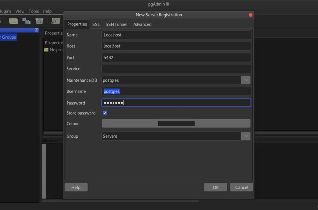
PostGIS is a robust and reliable spatial database extension for PostgreSQL. With this tool, we can store our spatial datasets in an RDBMS database such as PostgreSQL. There are many benefits when we store our…

The new QGIS 3.81 code name Zanzibar is now available for Windows, Mac and Linux. QGIS is a rich features, powerful GIS application that is available for free. In this article, we are going to…
Welcome to another QGIS Tutorial for Beginners. In this article, we are going to learn how to create a new shapefile in QGIS. As you might known already, QGIS supports many kind of spatial files…