
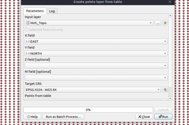
Hello, welcome to QGIS Tutorial. In this article, I am going to show you how to open Excel file in QGIS. I am using QGIS version 3.4.2 on Ubuntu 18.10. You may want to read…
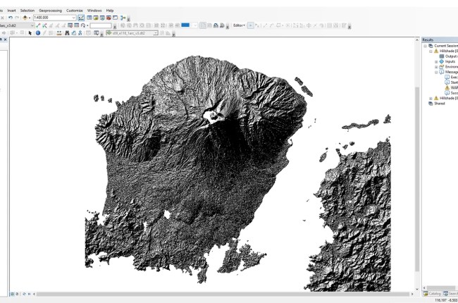
Hello, welcome to ArcGIS Tutorial for Beginners. In this tutorial, we are going to learn about how to create hillshade raster from SRTM on ArcGIS 10.6. Hillshade is a shaded relief from a surface layer considering…

Hello everyone, welcome to my website. Today I am going to show you how to clip a vector layer using polygon in ArcGIS 10.6. On my previous tutorial, you can learn how to clip a…

Welcome to another tutorial of QGIS. In this article, you will find out how to create random points inside a polygon. QGIS comes with many tools that we can use for many purposes. In my…