Hello everyone, welcome to another GIS Tutorial for Beginners. In this article, we will show you how to download high resolution Google satellite imagery. We are going to use a special software called Universal Maps Downloader. It is a tiny but powerful tool to download high resolution satellite imagery. It supports Google Satellite, Bing Imagery, and many others.
Universal Maps Downloader is a tool that
Basically, this software will download tile images from the server and then we can combine these tiles into a large and
Steps to Download High Resolution Google Satellite Imagery
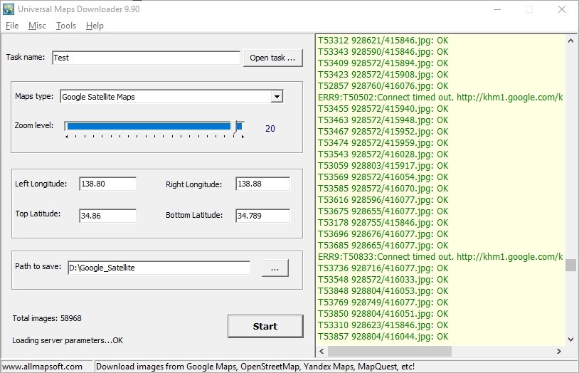
- First, open UMD and then give a new task name. Select Google Satellite Maps from the Maps type.
- Specify the zoom level. The higher zoom level produces better quality imagery but it takes much longer.
- Now, specify the area to download using the Left and Right Longitude, Top and Bottom Latitude.
- Specify the path to save the tile images.
- Click Start

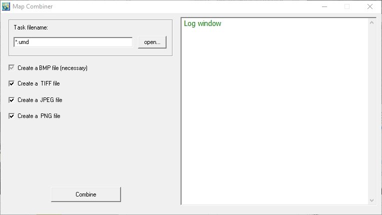
Wait until the download process is completed. Once the download process is completed, we need to combine the tile images. Go to Tools >> Map Combiner. This Map Combiner tool will automatically stitch all images into a single large image. You can choose the product image format such as JPG, GeoTiff and PNG.
To use Map Combiner, follow these steps below
- Open Map Combiner
- Click Open button and search for the task file you created from the previous download step
- Choose the format
- Click Combine button.
- Wait until the process completes

Thank you for reading this article. I hope you enjoy it and see you on the next GIS Tutorial.

