Hello everyone, in this article, we will learn how to export a feature layer to GPX file format on ArcGIS Pro. GPX is a spatial file that is commonly used by recent GPS such as Garmin. GPX, or GPS Exchange Format, is an XML schema designed as a common GPS data format for software applications. It can be used to describe waypoints, tracks, and routes. It is an open format and can be used without the need to pay license fees (Wikipedia).
In this example, I am going to export a point layer into GPX using ArcGIS Pro. We can convert the feature layer to GPX directly from ArcGIS Pro using the Feature to GPX tool. In the following example, I will export the point layer to the GPX.
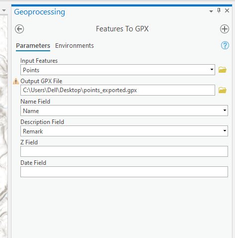
To do this, simply open the Features to GPX Tool from the ArcGIS geoprocessing.
Next, select the point layer from the Input Features. And then specify the output GPX layer. Additionally, we can also specify the Name Field, Description Field, Z Field, and Date Field.
Click Run to start the process. Done. That simple.


