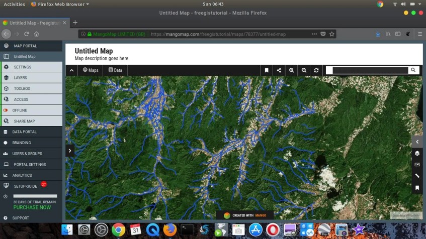
Ready to move to the web map? Today I got a chance to shortly review the Mangomap, a powerful and rich features Online mapping service. Mangomap is a web map service that allows us to create and visualize our data into nice maps. Doesn’t like other traditional GIS Mapping Software, Mangomap does not require any local installation. It fully uses the web browser such as Google Chrome, Firefox, and Opera to operate. You can then save the final maps and share them with your clients.
When you subscribed to Mangomap, you will be presented with a nice tour guide to get started. The information is very comprehensive and easy to understand even for a newbie. I used to use GIS software such as Mapinfo Professional, ArcGIS, and some others. Mangomap really easy to use and very helpful. Well, there are some missing features that usually exist on traditional GIS Software but I think this will be improved in the future.
Mangomap Features
- Easy to use with an interactive interface
- Supports various base map including Bing, Satellite imagery, hybrid map and many more
- Supports various data types such as Shapefile, KML, Mapinfo Table, File Geodatabase, CSV, WMS
- Share online maps to clients
- Easy to re-branding the maps
- Google Street View integration
- Simple dataset management via Data Portal
- For more information, please visit https://mangomap.com
Mangomap supports almost any Operating systems. The fact that it does not require installation, you can create beautiful maps from Windows, Mac, as well as Linux Operating System.
This is my very first time of using this software. The workflow and the toolbox are really helpful for me to start a new map. I can easily upload my data to the web interface, change the style and other properties easily.
It also very easy to switch between any available base map.
When ready, we can share our map by making it “online”. You can directly share the maps to social media, embed in an email, or even embed it on your website.
Access the free trial or purchase service to get the most of it.


