Hi, welcome to my GIS Blog. Let’s start this article with a little introduction to myself. I have been working in the Mineral Exploration company for more than 15 years now. I have been using various software to support my work. I am not a geologist but most of the time I work with geologists at different levels from junior geologist to senior and even a country manager. I provide data, maps, and some other materials during my period of work.
I am pretty familiar with GIS software such as Mapinfo, ArcGIS, QGIS as well as mining software like Micromine, Leapfrog Geo and some others. In this article, I want to share which software is good in the Mining industry, based on my own experience. Basically, no software is perfect. Each of them has its own pros and cons. That’s why if you want to jump into the industry, I suggest you to learn other software as well to support your work.
Here are some software that is commonly used in Exploration and Mining Industry.
A. Micromine
Micromine is a popular Mining Software. It is suitable for the Exploration stage, Resource Estimation as well as Mining. The modular license scheme allows the company to pick which license/modules suitable for the company stage. An exploration company may choose the exploration license rather than buy the resource estimation or mining license.
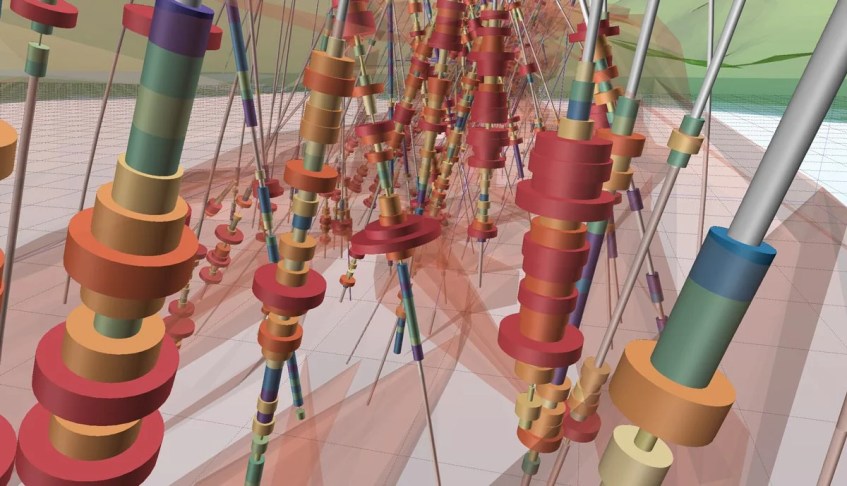
Building a complex geological map, drill hole 3D visualization, grid contouring, plotting can be done in Micromine. It also supports other file formats such as shapefile, mapinfo tab, excel, CSV, DXF and many more. We can also connect Micromine to the external ODBC database.
Features
Intuitive interface
First Micromine version I ever used is the Micromine version 10 back to the year of 2006, I guess. Compared to the most recent version, version 10 is still too complex to use especially when creating layout. Now, Micromine has evolved into a more intuitive, easy to use even for a new user.

Complete tools
You can find many tools in Micromine. Its pretty complex for a new user. The exploration module includes the core module and some other such as drill hole management, 3D view, basic gridding, and contouring, advanced DTM tool and many more.

To learn more about Micromine modules, features, and other stuff, please visit the official website below:
B. Leapfrog Geo
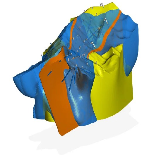
Leapfrog Geo is another popular geological modeling software. You can build your own geology model quickly in Leapfrog Geo. It has a new implicit modeling feature that everyone loved. It is very easy to build a simple or complex model from the drilling data. Leapfrog introduces a sophisticated way to produce a geological model. In the past, we need to create sections and then connect each section to build wireframes.

This manual way takes a long time and also becomes time-consuming when we have to modify the model as the drilling information becomes available. But Leapfrog Geo replaces these manual ways with a brand new algorithm.
Leapfrog Geo is very easy to learn especially if you are familiar with other GIS software such as Mapinfo, Surpac, or Micromine. LF also supports various file formats such as Surpac string, Micromine string, DTM, Mapinfo table, and Shapefile.
Main Features
- Simple and easy to use
- Fast learning curve
- Powerful with nice visualization
- Implicit modeling
- Domain modeling
C. MapInfo Pro with Discover
Well, MapInfo is also a well-known GIS software for mineral exploration companies. Together with the Discover software, it is very good for map-making tasks as well as drill hole data visualization. Even not as good as the two software I mentioned above, MapInfo Pro also has a built-in drill hole data visualization.
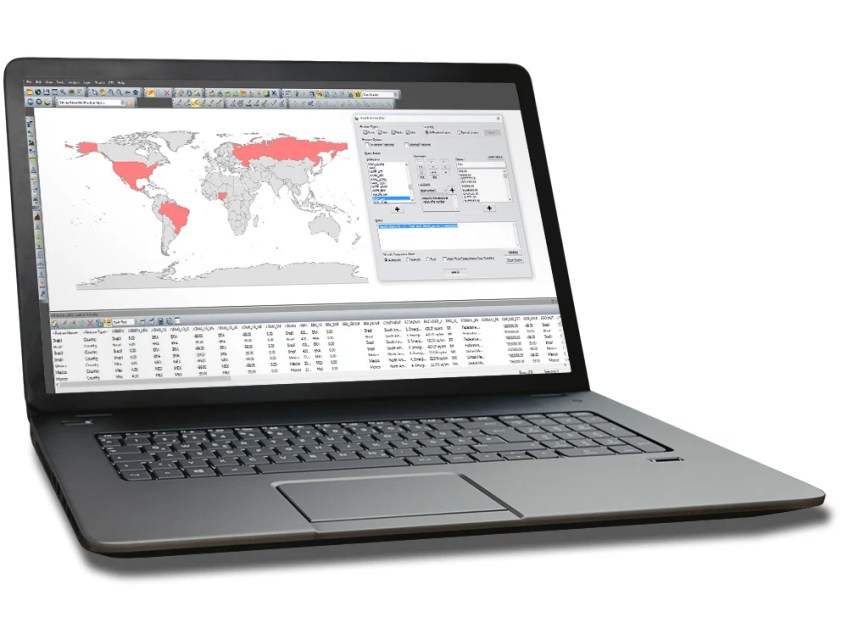
Mapinfo Pro with Discover also features 3D visualization. It can display drill hole, surface grid, wireframe, geophysics images and so on. Mapinfo Pro also usable in other businesses such as shipping business, postal management, etc. The additional Discover software is required in order to use Mapinfo Pro in the mineral exploration.
Mapinfo is suitable for exploration stage. It works very well on such tasks: map making, drill hole visualization, light modeling as well as 3D visualization. But for resource estimation, geological modeling and mining, there are many software that can do much better.
D. Geovia Surpac
Surpac is another great software for Mining and exploration companies. I am not using Surpac regularly but I learned the basic stuff. It is so complicated at the beginning. Compared to Micromine or Leapfrog Geo, Surpac is way more complex to me. Apart from that, Geovia Surpac is one of the most popular software for Geomodeling.
The new Geovia Surpac 2020 comes with many important features for Mining industries.
- Comprehensive tools include drill hole data management, geological modeling, block modeling, geostatistics, mine design, mine planning, resource estimation, and more.
- Modular and easily customized to adapt to changing needs.
- Expanded sharing of data, skills and project knowledge across teams and departments.
- Increased time savings with compliance to company-specific processes.
- Consistency of execution using task automation.
- Reduced data duplication with file format support of popular GIS and CAD systems.
- Integrated production scheduling with GEOVIA MineSched™.
- Multilingual support: English, Chinese, Russian, Spanish and French.
E. Datamine Studio
Datamine Studio is another product by Datamine. The same developer as the MapInfo Discover. It offers some great features for both explorations, the resource, and the mining stage. There are two different versions of the Datamine Studio. The Datamine Studio EM and RM. The Studio EM is optimized for geological analysis and modeling which is suitable for the exploration step. And the RM is specially designed for resource modeling, and mining.
F. RockWorks by RockWare
RockWorks by RockWare is a great software for geologists and geoscientists. It is a geology modeling software that has been around quite long in the business. Personally, I have never used this software but it also common in the geomodeling world.
The new version of RockWorks 17 includes many interesting features for geological analysis and 3D modeling. It also supports SQLite and SQL Server as the database back end. Generating drill hole cross section, interpreting geology made easier in this new version.
Extra Software for GIS
Even the following software do not support 3D modeling as good as the above software, but their existence is very good as supporting software.
QGIS is a free and open source GIS software that supports almost any GIS datasets. It also supports various database program such as SQL Server, PostgreSQL, Oracle. Start learning QGIS from the beginning by following our QGIS tutorial for Beginners.
Global Mapper is a well known GIS software for Windows. Its ability to open or convert multiple GIS file formats make this software is very important to GIS professionals.

Surfer is popular among geophysicist. This software has a special ability to create surface 3D grids and contours from multiple sources. It also very easy to use. You can easily create 3D grid from a CSV file and then save the grid format as .grd, .asc, and many more.
Thank you for reading this article. I hope you enjoy it and see you on the next GIS related articles.

Do you have any compilations of video tutorials or manuals for micromine, datamine, surpac, mapinfo, and surfer? I can’t seem to find a comprehensive tutorial on the internet.
Hi there,..sorry i dont have
Am interested in learning mining softwares from you.
Thanks