GIS Tutorial
  • Home
  • Categories
    • ArcGIS
    • Global Mapper
    • Mapinfo
    • Micromine
    • QGIS
  • About
  • Contact
  • Recommended Readings
    • MAPublisher
    • Micromine
    • The Best GIS Software

Popular Posts

How to open Mapinfo TAB file on QGIS
QGIS,

How to open Mapinfo TAB file on QGIS

by adminJanuary 1, 20181 comment
How to convert polyline to polygon on QGIS 3.0
QGIS,

How to convert polyline to polygon on QGIS 3.0

by adminJune 12, 2018no comment
How to Create a GeoPackage on QGIS 3.2
QGIS,

How to Create a GeoPackage on QGIS 3.2

by adminJuly 25, 2018no comment
How to Install PostGIS on Ubuntu 18.04
Database,

How to Install PostGIS on Ubuntu 18.04

by adminAugust 5, 20185 comments

Category List

  • ArcGIS (39)
  • Database (23)
  • Free Spatial Data (2)
  • GIS Software (15)
  • Global Mapper (19)
  • Leapfrog Geo (11)
  • Mapinfo (40)
  • Micromine (27)
  • QGIS (73)
  • Surfer (2)
  • Uncategorized (2)

Follow Us

Instagram

Instagram has returned invalid data.
GIS Tutorial
  • Home
  • Categories
    • ArcGIS
    • Global Mapper
    • Mapinfo
    • Micromine
    • QGIS
  • About
  • Contact
  • Recommended Readings
    • MAPublisher
    • Micromine
    • The Best GIS Software
QGIS,

How to Extract Verticles in QGIS

by adminSeptember 25, 20191 comment
0
Shares
Share on FacebookShare on Twitter
extract-verticle-in-qgis

Hello everyone, welcome to another QGIS Tutorial. In this article, I am going to show you how to extract verticles in QGIS. As you know, polyline features are constructed from two or many connected points. In case you need to extract the points that construct the line, you can do it in QGIS with few simple steps.

So here is the example. Below is a contour layer in my QGIS canvas.

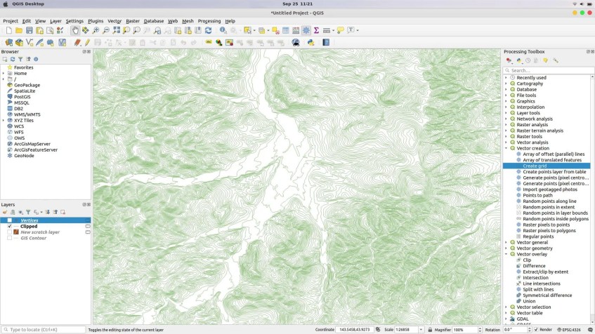
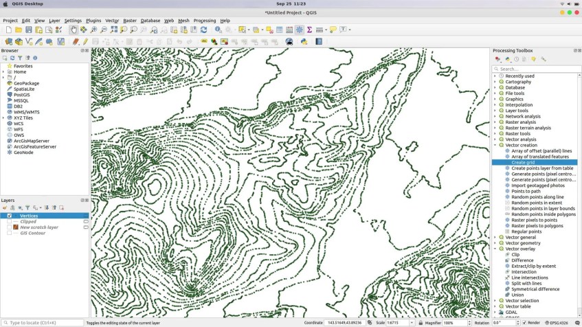
As you can see there are many polylines in the layer. Now after I extract the verticles, it turn into this one

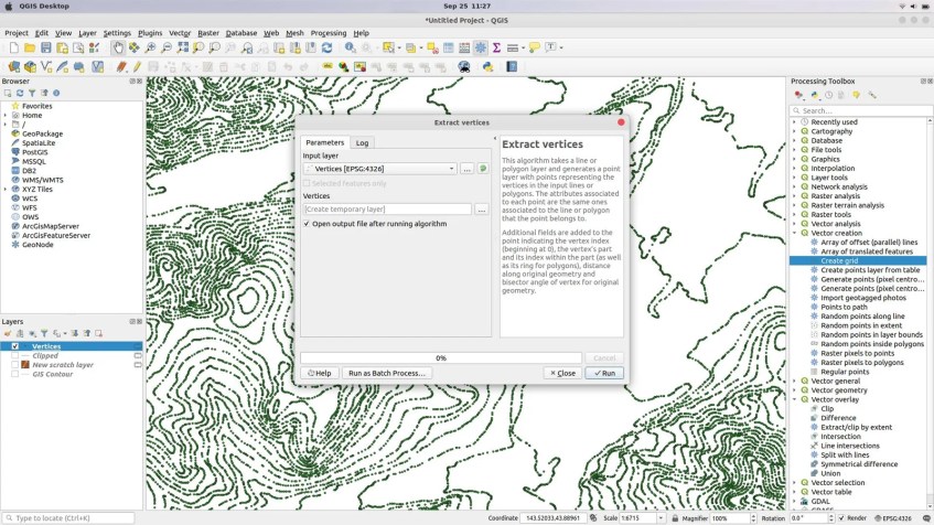
So how to do that? It is very simple. Simply follow the steps below to extract verticles in QGIS

  1. Open QGIS
  2. Load the polyline layer into QGIS canvas
  3. Go to Vector >> Geometry Tools >> Extract Verticles
  4. Specify the input layer
  5. Optionally, you can also specify the output layer. If you do not specify, QGIS will create a temporary layer which we can save it later.
  6. Click Run

OK so now we have a new layer containing the points or verticles. Thank you.

qgis tutorialverticles
Previous

How to Import GPX File to MapInfo Pro

September 16, 2019
Next

How to Import DXF into 3D Wireframe in Micromine

October 10, 2019

1 Comment

How to Extract Points from Polygon in MapInfo Professional | GIS Tutorial

November 6, 2020

[…] Done. Now we have new point layer files which can be used for other purposes. If you don’t have MapInfo Professional, you can also use QGIS to extract verticles. […]

Reply

Leave a Reply Cancel reply

Trending

  • How to Create Catchment Area on ArcGIS

    How to Create Catchment Area on ArcGIS

    2 months ago
  • Import Elevation Grid on Leapfrog Geo 6.0

    Import Elevation Grid on Leapfrog Geo 6.0

    2 months ago
  • How to Clip Raster Against Polygon in QGIS

    How to Clip Raster Against Polygon in QGIS

    2 months ago
  • How to Extract Points from Polygon in MapInfo Professional

    How to Extract Points from Polygon in MapInfo Professional

    2 months ago

Follow Us

Ads


Ads


Categories

  • ArcGIS (39)
  • Database (23)
  • Free Spatial Data (2)
  • GIS Software (15)
  • Global Mapper (19)
  • Leapfrog Geo (11)
  • Mapinfo (40)
  • Micromine (27)
  • QGIS (73)
  • Surfer (2)
  • Uncategorized (2)