

In this tutorial, I will guide you on how to install PostGIS on Ubuntu 20.04. In the previous article, I have shown how to install PostGIS on Ubuntu 18.04. I want to update the article…
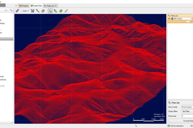
Hello everyone, welcome to the LeapFrog tutorial for absolute beginners. In this article, we will learn how to create Topography from the point data. There are several ways to create Topography in LeapFrog. In my…

In this article, we will show you how to generate contour form a DEM in ArcMap 10.8.1. Generating contour from a DEM in ArcMap is a very easy and simple task. As long as we…
Welcome to Global Mapper Tutorial. In this article, we will show you how to create DEM using Global Mapper. We will generate the DEM (Digital Elevation Model) from a contour layer. Global Mapper is capable…