Tag: qgis tutorial
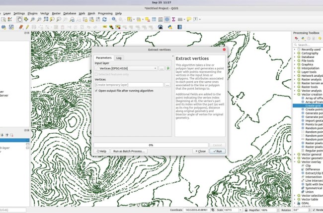
Hello everyone, welcome to another QGIS Tutorial. In this article, I am going to show you how to extract verticles in QGIS. As you know, polyline features are constructed from two or many connected points.…

QGIS is a complete GIS Application that supports many data sources both offline and online. In this article, we are going to learn about how to add ArcGIS REST Service in QGIS. ArcGIS REST Service…

For most GIS persons, exporting the map to a georeferenced image is an important task. When we export a map to a georeferenced image, we can then open the image in other GIS software. And,…

The new QGIS 3.81 code name Zanzibar is now available for Windows, Mac and Linux. QGIS is a rich features, powerful GIS application that is available for free. In this article, we are going to…