

Hello everyone, welcome to my Micromine Tutorial. In this article, we are going to learn how to digitize points in Micromine. In other words, we will show you how to create points in Micromine by…
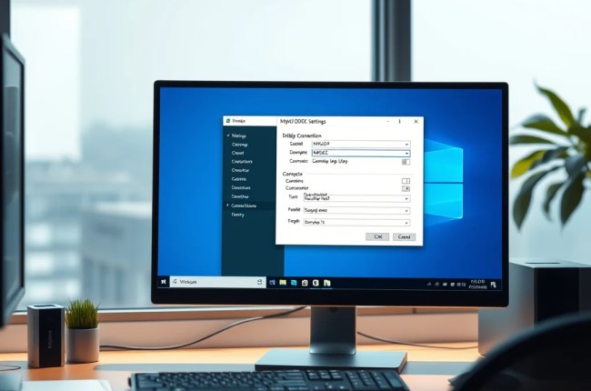
In this article, we will show you how to create a MySQL ODBC Connection on Windows 11. With this ODBC Connection, we can use it to connect our GIS software to the MySQL database directly.…
This short tutorial will guide you how to count points inside polygon in QGIS. I have a point layer that has many points and also I have a polygon layer. We will try to count…

The latest version of Fedora 41 is now available for download. Fedora is a beautiful, secure Linux distribution. If you want to try or install this Linux distribution on your laptop or PC, you may…